Yunnan-Tibet Highway Road Trip: How Many Days from Kunming to Lhasa? G214 to G318 Route, Stops & Itinerary
"Want to drive all the way from Yunnan into Tibet — how does the Yunnan-Tibet Highway actually go?" It is the route into Tibet with the richest variety of scenery: from the mild shores of Erhai Lake to the sacred Meili Snow Mountain, from the steep Lancang River canyon to the "little Jiangnan" of Nyingchi, altitude rises step by step and the landscape shifts with it.
From Kunming, follow National Road G214 north through Dali, Lijiang, Shangri-La and Meili Snow Mountain, join G318 (Sichuan-Tibet Highway) at Markam, and head west to Lhasa — about 1,930 km in total. This route deserves 6-8 slow days. It is not a route for rushing — it's a route you can't bear to drive fast.
🗺️ Route Overview: How to Get from Kunming to Lhasa
Kunming → Dali → Lijiang → Shangri-La → Deqin (Meili Snow Mountain) → Yanjing → Markam (join G318) →
Zogang → Rawok Lake → Bomê → Nyingchi → Lhasa
The full distance is about 1,930 km, ideally done in 7 days at 250-300 km per day. The first section (Kunming to Markam) is the core Yunnan-Tibet stretch, packed with snow mountains, canyons and grasslands; the second section (Markam to Lhasa) overlaps the Sichuan-Tibet South line, centered on Rawok Lake, the Bomê forests and the Nyingchi river valley.
📅 Daily Itinerary (Recommended 7-Day Plan)
Day 1: Kunming → Dali (about 320 km, 4.5 hours)
Leave Kunming in the morning on the G56 Hangzhou-Ruili expressway and arrive in Dali by noon. In the afternoon self-drive along the east shore of Erhai Lake to Shuanglang old town and watch the sunset over Cangshan and the lake. Dinner in Dali Old Town: a bowl of Bai-style sour-spicy fish.
- 🏨 Stay: Dali Old Town / Shuanglang (about 1,980 m)
- 📸 Highlights: Erhai lakeside road, Shuanglang sunset
- 💡 Tip: Today's altitude is low — it's your last "sea-level time" before entering Tibet. Rest well.
Day 2: Dali → Lijiang → Shangri-La (about 320 km, 6 hours)
Take the G5611 Dali-Lijiang expressway to Lijiang in the morning and wander Shuhe old town (quieter than Dayan). In the afternoon join G214, cross the Jinsha River Grand Canyon, pass the Tiger Leaping Gorge viewpoint, and reach Shangri-La. In the evening stroll Dukezong old town and turn the world's largest prayer wheel.
- 🏨 Stay: Shangri-La city (about 3,300 m)
- ⚠️ Note: Altitude jumps from 1,980 m to 3,300 m — mild altitude sickness is possible on the first night; move slowly and skip alcohol
- 📸 Highlights: Tiger Leaping Gorge, Dukezong night scene
Day 3: Shangri-La → Deqin (about 180 km, 4 hours)
Today the scenery becomes spectacular. Cross Baima Snow Mountain Pass (4,292 m) and see the golden sunrise (Nikkō Kinsen) of Meili Snow Mountain for the first time from the Wunongding viewpoint. Arrive at Deqin town or Feilaisi (Flying Temple) in the evening and stay overnight, waiting for the dawn view of Meili's main peak, Kawagarbo.
- 🏨 Stay: Feilaisi (best spot for viewing Meili)
- 📸 Highlights: Baima Snow Mountain, Meili from both Wunongding and Feilaisi
- ⚠️ Note: Feilaisi sits at about 3,400 m — stay warm and guard against altitude sickness
Day 4: Deqin → Yanjing → Markam (about 220 km, 5 hours)
After the Meili Snow Mountain golden sunrise (Kawagarbo, 6,740 m), set off along the Lancang River canyon. Pass Yanjing — home of Tibet's only Catholic church and thousand-year-old ancient salt fields. In the afternoon reach Markam, where G214 and G318 meet — from here you're officially on the main route into Tibet.
- 🏨 Stay: Markam town (about 3,850 m)
- 📸 Highlights: Meili sunrise, Yanjing salt fields
- 💡 Tip: Markam is a supply point on the way in — top up fuel, water and food here
Day 5: Markam → Zogang → Rawok Lake (about 370 km, 7 hours)
Today is the densest stretch of mountain crossings in the Hengduan range: Jueba Mountain (3,911 m), Dongda Mountain (5,130 m) — one of the highest passes on the Sichuan-Tibet line — then Yela Mountain (4,658 m) overlooking the "Nujiang 72 Bends". Overnight at Rawok Lake; the snow-mountain reflection at dawn the next morning is one of the most classic images on the whole route.
- 🏨 Stay: Rawok town (about 3,850 m)
- 📸 Highlights: Nujiang 72 Bends, Rawok Lake reflection
- ⚠️ Note: Dongda Mountain is 5,130 m — move slowly when getting out to shoot, and guard against severe altitude sickness
Day 6: Rawok Lake → Bomê → Nyingchi (about 360 km, 6.5 hours)
In the morning visit Laigu Glacier or Midui Glacier (one of China's most beautiful glaciers), then drive through the Bomê Gangxiang spruce forest — dubbed a "natural oxygen bar," the most oxygen-rich, most Jiangnan-like stretch on the route. In the afternoon cross Sela Pass (4,728 m); with luck you'll glimpse the tip of Namjagbarwa Peak (7,782 m). Reach Nyingchi by evening.
- 🏨 Stay: Nyingchi city (about 2,950 m)
- 📸 Highlights: Laigu/Midui glaciers, Lulang forest sea, Namjagbarwa
- 💡 Tip: Nyingchi's low altitude offers a rare comfortable night's sleep on the way in
Day 7: Nyingchi → Lhasa (about 400 km, 5.5 hours)
Take the Linzhi-Lhasa expressway west in the morning — speed limit 100 km/h, the easiest day of the whole route. Cross Mila Pass (5,013 m) at midday and arrive in Lhasa in the afternoon. The 1,930 km Yunnan-Tibet drive is complete.
- 🏨 Stay: Lhasa city (about 3,650 m)
- 📸 Highlights: Niyang River valley along the expressway, Mila Pass
- 💡 Tip: On arrival day in Lhasa, no shower and no strenuous exercise — save your energy for the Potala Palace tomorrow
🚙 Vehicle Recommendations
| Vehicle | Best For | Notes |
|---|---|---|
| City SUV | Standard driving | Overall road conditions are okay; Highlander/RAV4 class is enough |
| Off-road 4x4 | Extra detours to Yubeng, Rawok trails | Tank 300/Prado for unpaved stretches with more confidence |
| Sedan | Avoid with care | Markam-Zogang and the 72 Bends have many potholes; low clearance risks grounding |
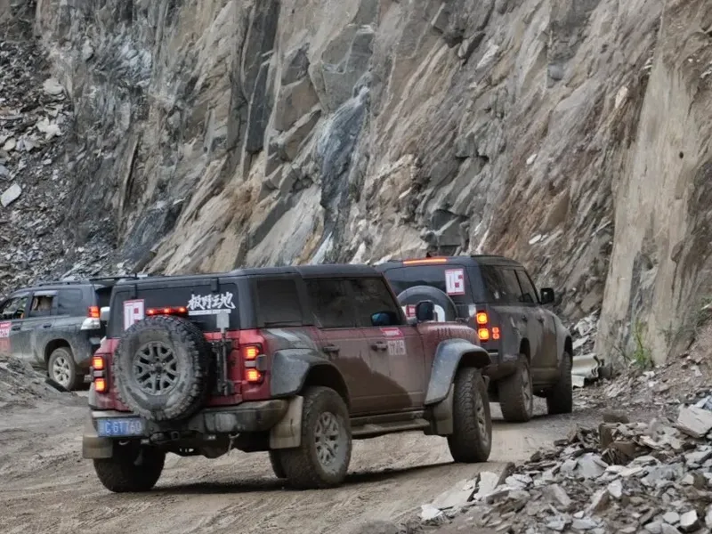
Driving tips: About 70% of the Yunnan-Tibet Highway is paved, but the Deqin-Markam section and the Nujiang 72 Bends have many curves, hazardous stretches and rockfall zones — be extra careful in the rainy season (July-August). Check road conditions every morning; if there's a landslide or traffic control, detour or wait without hesitation.
⛽ Fuel & Supplies
- Fuel stations: Frequent from Kunming to Dali; available in Shangri-La, Deqin, Markam, Zogang, Baxoi, Bomê and Nyingchi — but the gap between Markam and Zogang is long, so fill up before leaving
- 92-octane note: Some remote stations only carry 92 octane; turbo-charged cars should plan ahead
- Supplies: Dali, Shangri-La and Nyingchi are the three big supply points; Markam and Zogang have limited options, so buy snacks and water in advance
💰 Cost Estimate (per person, excluding flights)
| Item | Budget | Notes |
|---|---|---|
| Rental + fuel + tolls | 3,500-5,500 yuan | Based on 4 people sharing one SUV; expressway sections are in Yunnan |
| Accommodation | 1,800-2,600 yuan | Shangri-La, Nyingchi, Lhasa are comfortable; Deqin, Rawok are basic |
| Tickets | 800-1,200 yuan | Jade Dragon/Tiger Leaping Gorge, Meili viewpoints, Yanjing, Laigu Glacier etc. |
| Food | 1,400-2,000 yuan | 80-120 yuan/day per person; more choices on the Yunnan side |
| Total | About 7,500-11,000 yuan/person | Flexible depending on style |
🏔️ The Altitude Ladder: The Yunnan-Tibet Advantage
The smartest thing about this route is the stepped altitude gain: Kunming 1,900m → Dali 1,980m → Shangri-La 3,300m → Deqin 3,400m → Markam 3,850m → Rawok 3,850m → Nyingchi 2,950m → Lhasa 3,650m.
Compared with G109's immediate jump to 4,500 m, the Yunnan-Tibet route gives your body a 3-4 day buffer to acclimatize, and altitude sickness is noticeably less common. This is why many people call it "the friendliest route into Tibet for beginners."
🗓️ Best Season & Weather
- April-June: Azaleas bloom, snow mountains are clear, before the rainy season — the golden period for photography
- September-November: Stunning autumn colors, stable weather, best visibility of the year
- July-August: Rainy season; high rockfall and landslide risk on the 72 Bends and Markam sections — not for novice drivers
- December-March: Baima and Dongda mountains may be snowed in; road conditions are unpredictable
Weather notes: Altitude varies hugely along the route — all four seasons in a day. Sun protection is a lifelong job: sunglasses, sunscreen and a sun hat are non-negotiable; even in summer you need a windbreaker at the passes.
📋 Checklist & Notes
- Border permit: Not needed for the route itself, but if you plan to visit border areas like Yubeng village (in Deqin), arrange one in your hometown in advance
- Rockfall & landslides: In the rainy season, watch the hillsides on canyon stretches and pass quickly — don't stop for photos
- Curves & oncoming traffic: On sections like the 72 Bends, honk at blind curves and stay right
- Altitude medication: Take Rhodiola in advance, keep ibuprofen and portable oxygen in the car, and move slowly at the Dongda Pass
- Offline maps: Some mountain sections between Markam and Rawok have no signal — download offline maps and the route guide in advance
💬 What RoamFun Travelers Say
"The Yunnan-Tibet Highway is the ceiling of scenery I've ever driven. The golden sunrise on Kawagarbo at Feilaisi — when the gold spilled over the snow mountain, someone in our convoy literally cried. The altitude rises slowly; all four of us in the car barely got altitude sickness." — Aze, Hangzhou ⭐⭐⭐⭐⭐
"The Nujiang 72 Bends was the most stunning — from the top it looks like a silver dragon coiling down. A warning: be cautious in the rainy season. We just made it through before a heavy storm, and that section slid the next day." — Dapeng, Shenzhen ⭐⭐⭐⭐⭐
The Yunnan-Tibet Highway: China's Most Beautiful Drive
From the mild shores of Cangshan and Erhai, to the sacred Meili Snow Mountain; from the thrill of the Lancang canyon, to the tenderness of the Nyingchi valley — the Yunnan-Tibet Highway strings together China's most extreme southwestern scenery in 1,930 km. This is a route made for slow driving; rushing it would be an insult.
If you don't want to drive yourself but still want this experience, a chartered tour is an excellent option — local drivers who know the road will steer you past rainy-season landslides and time the golden-sunrise spot at Feilaisi precisely.
Craving a worry-free yet free-spirited trip?
Don't want to plan? Contact a senior travel designer now for your personalized route and quote.
Get Your Free Route Guide & Quote
Updated: August 2026 Author: RoamFun Senior Travel Consultant Questions? Contact us: vip@roamfun.net

RoamFun Senior Travel Consultant
Travel DesignerProfessional travel consultant, curating the most practical travel guides for you.