Qinghai-Tibet Highway Road Trip Guide: How Many Days from Golmud to Lhasa? G109 Road Conditions, Stays & Altitude Sickness Tips
"Should I take the Qinghai-Tibet Highway or the Sichuan-Tibet Highway for my first drive into Tibet?" — This is the first decision every self-driver faces. If your goals are time-saving, simple roads and vast, magnificent scenery, the answer is clear: take the Qinghai-Tibet Highway (G109).
The Qinghai-Tibet Highway is fully paved and is the simplest and quickest of the five routes into Tibet — but it is also the highest on average. From Golmud to Lhasa it is about 1,160 km, almost entirely above 4,500 m, with Wudaoliang and the Tanggula Pass even exceeding 5,000 m. The road is easy; altitude sickness is not. This is a route that is "physically hard, but easy to drive."
🗺️ Route Overview: How to Get from Golmud to Lhasa
Golmud → Xidatan (Yuzhu Peak) → Kunlun Pass (4,767m) → Wudaoliang → Tuotuo River (Yangtze source) →
Tanggula Pass (5,231m) → Amdo → Nagqu (4,500m) → Damxung (Nam Co turnoff) → Yangbajain → Lhasa
The full distance is about 1,160 km, usually completed in 2-3 days. Speed-runners finish in 2 days; cautious drivers take 3. The 3-day pace is what most people recommend — the average altitude is simply too high, so keep each day under 400 km and sleep at lower-altitude towns to noticeably reduce altitude sickness risk.
📅 Daily Itinerary (Recommended 3-Day Plan)
Day 1: Golmud → Tuotuo River Town (about 420 km, 7 hours)
Depart Golmud in the morning and climb steadily from 2,800 m. The first stop is Xidatan, with Yuzhu Peak (6,178 m) towering ahead — the highest peak in the eastern Kunlun range. Continue over Kunlun Pass (4,767 m) and enter the edge of the Hoh Xil no-man's-land, where you may well spot Tibetan antelopes and wild kiangs.
In the afternoon pass Wudaoliang — locals say "reach Wudaoliang and you'll cry for your mother" — one of the most altitude-sick stretches on the highway. Arrive at Tuotuo River Town, the source of the Yangtze River, home to a Yangtze Source Monument and the Tuotuo River Bridge.
- 🏨 Stay: Tuotuo River Town (about 4,530 m, basic accommodation)
- ⚠️ Note: Sleeping above 4,500 m on the first night can worsen symptoms at night; take anti-altitude medication early
- 📸 Highlights: Kunlun Pass monument, Hoh Xil antelopes
Day 2: Tuotuo River → Amdo → Nagqu (about 460 km, 7 hours)
Today is the highest stretch of the whole route. Set off at dawn and cross Tanggula Pass (5,231 m) — the highest point of the highway and the border between Qinghai and Tibet. The wind is strong and oxygen is thin at the pass; don't linger for photos and keep warm.
In the afternoon you enter Tibet proper, pass Amdo County and reach Nagqu. The city sits at 4,500 m, the highest prefecture-level city in Tibet. Stay overnight in Nagqu — hotels here generally have oxygen supply.
- 🏨 Stay: Nagqu city (4,500 m, choose a hotel with oxygen)
- ⚠️ Note: The Tanggula Pass stretch is windy year-round, icy in winter, and may see heavy rain or hail in summer — drive slowly
- 💡 Tip: If altitude sickness is severe, drive straight from Amdo to Damxung (150 km more, but lower altitude)
Day 3: Nagqu → Damxung → Yangbajain → Lhasa (about 330 km, 6 hours)
Depart Nagqu in the morning, cross Senge Pass (4,880 m) and descend gently. At Damxung there is a famous turnoff — turning right takes you to Nam Co (needs an extra half-day). Continue past Yangbajain, a geothermal hot spring area where you can stop and soak your feet to recover.
In the afternoon cross the Nyenchen Tanglha viewpoint and the Lhasa River valley opens up before you. Arrive in Lhasa by evening, where the altitude drops to 3,650 m and you can finally breathe easy.
- 🏨 Stay: Lhasa city (3,650 m — sleep quality improves greatly once acclimatized)
- 📸 Highlights: Nyenchen Tanglha snow peaks, Lhasa River valley sunset
- 💡 Tip: Don't wash your hair, shower or do strenuous exercise on arrival day — let your body adapt slowly
🚙 Vehicle Recommendations
| Vehicle | Best For | Notes |
|---|---|---|
| City SUV | Standard driving | Fully paved road; RAV4/Highlander class is plenty |
| Sedan | Budget & fuel economy | Doable on simple roads, but go slow over potholes with low clearance |
| Off-road 4x4 | Detours into Hoh Xil | Tank 300/Prado for unpaved tracks with more confidence |
Driving tips: G109 has the best surface of the five routes into Tibet, but don't be careless just because it's easy. There are lots of subsidence and hidden potholes, heavy truck traffic and frequent overtaking — keep your speed at 60-80 km/h. Renting in Golmud usually allows one-way returns in Lhasa; confirm the terms in advance.
⛽ Fuel & Supplies
- Fuel stations: Available at Golmud, Xidatan, Wudaoliang, Tuotuo River, Amdo, Nagqu and Damxung, but gaps can reach 150-250 km — fill up at half a tank, always
- Diesel note: High altitude cuts diesel power noticeably; turbo-diesel engines cope better than naturally aspirated ones
- Supplies: Stock up on water and snacks in Golmud before leaving — shops in Tuotuo River and Amdo have limited choices at higher prices
💰 Cost Estimate (per person, excluding flights)
| Item | Budget | Notes |
|---|---|---|
| Rental + fuel + tolls | 2,500-4,000 yuan | Based on 4 people sharing one SUV; tolls are low on G109 |
| Accommodation | 1,000-1,500 yuan | Tuotuo River and Nagqu are basic, averaging 200-300/night |
| Food | 700-1,000 yuan | Mostly Sichuan restaurants; 60-80 yuan/day per person |
| Altitude meds + oxygen | 200-500 yuan | Oxygen bag/portable canisters, Rhodiola, ibuprofen |
| Total | About 4,500-7,000 yuan/person | Flexible depending on style |
🏔️ Altitude Sickness: The Real Challenge of G109
With an average altitude above 4,500 m, altitude sickness is the biggest enemy on this route — more important than road conditions:
- Prepare early: Start taking Rhodiola 1-2 weeks before departure (results vary), and pack ibuprofen (for headaches) and oral glucose
- Oxygen supply: Carry portable oxygen canisters or a bag in the car; oxygen around Tuotuo River and Tanggula Pass is only half of sea level
- Slow-motion rule: Even moving luggage feels exhausting above 4,500 m — slow everything down
- Watch for pulmonary edema: Persistent severe headache, cough with pink frothy sputum, or shortness of breath that doesn't improve with rest means you must descend immediately and seek medical help
- Choose lower overnight spots: Nagqu (4,500m) → Damxung (4,200m) → Lhasa (3,650m), each night more comfortable than the last
🗓️ Best Season & Weather
- Mid-May to June: Grass turns green, oxygen levels rise, fewer crowds
- July-September: Highest oxygen of the year and most stable weather — the top choice for most; heavy rain possible around Nagqu and Tuotuo River in the rainy season
- October: Autumn colors plus clear skies, but temperatures drop sharply
- November-April: Winter storms are common and the Tanggula Pass is often under traffic control — beginners should not drive G109 in winter
Weather notes: You can experience all four seasons in one day. Bring a down jacket even in July. Sunglasses are essential — prolonged glare off snow can cause snow blindness.
📋 Checklist & Notes
- Documents: No border permit is needed to enter Tibet, but if you plan to visit border regions like Everest, Ngari (Ali) or Shannan, apply for the border permit in your hometown or in Lhasa in advance
- Speed: Speed cameras and interval checks are dense on G109 — don't speed and don't squeeze past trucks
- Wildlife: Tibetan antelopes and kiangs cross the road in the Hoh Xil section — slow down and let them pass; never chase them on foot
- Booking: July-September rooms in Tuotuo River and Nagqu are tight; book about 1 week ahead
- Signal: No phone signal in the Hoh Xil no-man's-land — download offline maps and keep your convoy in sight
💬 What RoamFun Travelers Say
"Everyone says G109 is the easiest of the five routes, but driving it myself I realized it's hard because of altitude, not the road. Slow down and spread it over 3 days and altitude sickness is manageable. The stars at Tuotuo River and the prayer flags at Tanggula Pass are images I'll never forget." — Lao Zhang, Chengdu ⭐⭐⭐⭐⭐
"For my first drive into Tibet I didn't dare take the Sichuan route and chose G109. The paved road was so smooth, and we really did see Tibetan antelopes in Hoh Xil! Just bring oxygen — my husband got hit by altitude sickness at Wudaoliang and we got through to Nagqu with a portable canister." — Xiao Yu, Guangzhou ⭐⭐⭐⭐⭐
G109 Is the First Lesson of Entering Tibet
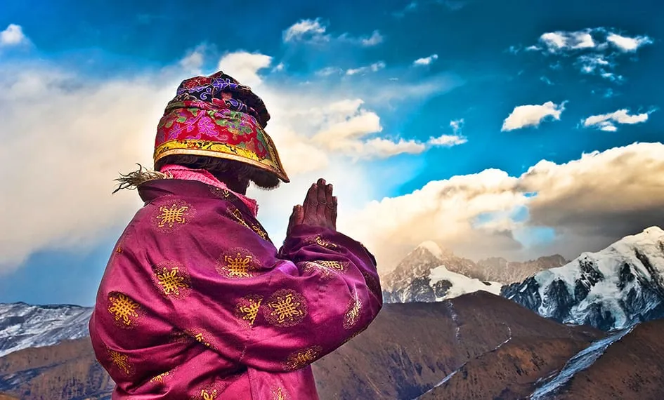
G109 has none of the Sichuan route's dizzying hairpins or the Yunnan route's snow-capped canyons. Its beauty is another kind — vast, open and lonely. Drive for two hours through the Hoh Xil no-man's-land without seeing another car, take a breathless photo beneath the prayer flags at 5,231 m on Tanggula Pass, and you'll understand why so many people endure altitude sickness to come here once.
If you'd rather not drive yourself, or worry about altitude sickness with no one to help, consider a chartered tour — experienced drivers know the road and supply points, and can respond the moment altitude sickness hits.
Craving a worry-free yet free-spirited trip?
Don't want to plan? Contact a senior travel designer now for your personalized route and quote.
Get Your Free Route Guide & Quote
Updated: August 2026 Author: RoamFun Senior Travel Consultant Questions? Contact us: vip@roamfun.net

RoamFun Senior Travel Consultant
Travel DesignerProfessional travel consultant, curating the most practical travel guides for you.