Ngari Grand Loop Self-Driving Guide: What It Takes to Reach the Roof of the Roof of the World
Ngari—west of Tibet, averaging 4500m altitude, called the "Roof of the Roof of the World." Here lies the holy mountain Kailash, sacred lake Manasarovar, the Guge Kingdom ruins, and Zanda Earth Forest—any single name is legendary in outdoor travel circles.
But listen to me: those online posts saying "Ngari Grand Loop—a must-do in your lifetime" only show you photos of golden sunrise on Kailash, not the reality that above 4500m, every breath depletes your life force.
I've run the Ngari route over twenty times—blown tires, been trapped by snow-blocked roads, evacuated guests. This guide lays out every pitfall.
🚙 Veteran's Straight Talk: Not Every Car Can Handle the Ngari Road
Driving around Lhasa city—any car works. But the Ngari route is different—past Shigatse heading west, paved roads become increasingly rare, washboard and gravel roads become the norm. The stretch from Zanda Earth Forest to Guge ruins will bottom out low-chassis vehicles on rocks.
The Prado is the standard vehicle for Ngari. The reasons are simple:
- High ground clearance, no scraping on washboard roads
- 4WD system works in rainy season mud and winter ice
- Parts are findable in Tibet (every county town has Prado repair shops)
- Large space—supplies in the back, people in the front
Most important: Don't drive the Ngari route yourself. The full 4000km route reaches nearly 5600m at its highest. After driving all day at 5000m, by evening your attention is equivalent to having drunk two beers. Find an experienced driver who knows the roads—you just look at scenery and take photos, leave safety to professionals.
🗺️ Hard-Earned Itinerary: 13 Days, Southern Route In, Northern Route Out
Day 1: Lhasa - Yamdrok Lake - Shigatse (380km)
- Itinerary tip: Yamdrok Lake viewpoint is packed—don't squeeze in at Kampala Pass. Drive down to the lakeshore—fewer people, closer water, bluer color.
- Road warning: Lhasa to Shigatse is fully paved, good conditions. Kampala Pass mountain road has steep grades, motion sickness prone.
- Veteran's advice: Baidi Village by Yamdrok has a tea house with the best sweet tea on the entire lake—sitting by the window looking at the lake is 10,000 times more comfortable than shooting for ten minutes at the viewpoint and leaving.
Day 2: Shigatse - Sakya Monastery - Lhatse (200km)
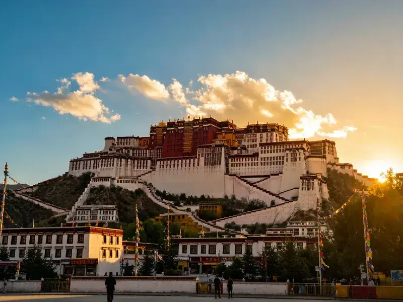
- Itinerary tip: Shigatse's Tashilhunpo Monastery is worth a full morning. It's the Panchen Lama's seat, as grand as the Potala Palace but with only one-fifth the tourists. The Maitreya Buddha Hall's 26m gilded copper statue is the world's largest indoor gilded copper Buddha.
- Veteran's advice: Sakya Monastery—the ancestral monastery of the Sakya sect of Tibetan Buddhism. Gray walls look like a castle from afar. The monastery houses over 10,000 palm-leaf scriptures written in gold and silver ink, called the "Second Dunhuang."
Day 3: Lhatse - Everest Base Camp (Environmental Bus Access Only)
- Itinerary tip: Going to Everest requires a border pass (obtain at your registered residence location or in Lhasa). From Tingri county town, after buying tickets, drive about 100km more on mountain roads to the transfer point, then take the environmental bus to base camp.
- Veteran's advice: Stay at the base camp tent lodge (100-150 yuan/person). Get up at 3-4 AM for stars—Everest Base Camp is one of China's most stunning stargazing spots.
Day 4-5: Everest - Saga (about 350km)
- Itinerary tip: Coming down from Everest, the road from Old Tingri to Saga officially enters "washboard road mode"—dirt roads pressed into ribbed strips by trucks. Drive fast and the car shakes constantly; drive slow and it bumps all day. 40-60km/h is the sweet spot.
- Veteran's advice: Saga is the last proper county town before entering Ngari. Stock up here—fill up on gas, water, and snacks. Once in Ngari, supply stations are 200-300km apart.
Day 6-7: Saga - Lake Manasarovar - Darchen (Foot of Mount Kailash)
- Itinerary tip: Lake Manasarovar (sacred lake) and Lake Rakshastal (ghost lake) are separated by one embankment but vastly different—Manasarovar is freshwater, sweet; Rakshastal is saltwater, bitter. Don't mix them up, and definitely don't drink Rakshastal water.
- Road warning: This stretch becomes wide open and straight—so straight you'll get drowsy. Driver's rule: stop every hour and walk for five minutes.
- Veteran's advice: Darchen is the starting point for the Kailash kora (circumambulation), at 4650m. If you plan to do the kora (52km/2-3 days), rest one full day in Darchen before starting. The kora isn't a fitness challenge—it's high-altitude long-distance trekking, 20km/day above 4000m.
Day 8-9: Zanda Earth Forest - Guge Kingdom Ruins
- Itinerary tip: Zanda Earth Forest looks completely different under different light—noon is a white-washed nothing, sunrise and evening bring out the 3D depth. You must stay at least one night in Zanda to catch the next morning's sunrise.
- Veteran's advice: Guge Kingdom ruins—arrive by 6:30 AM. First light on the ruins—golden castle + earth forest backdrop, one of Tibet's top three most stunning scenes. The ruins have many steep steps, 550m elevation gain, starting at 3800m—significant physical exertion.
Day 10-13: Northern Route Return — Shiquanhe → Gaize → Nyima → Baingoin → Namtso → Lhasa
The northern route is long—about 300-400km per day, mostly grassland dirt roads and gravel. You'll pass countless "tso" (Tibetan for "lake"), one after another—Siling Tso, Tangra Yumco, Zhari Namco. Each lake is unrealistically blue.
- Veteran's advice: Siling Tso is Tibet's largest lake (larger than Namtso) but has fewer than one-tenth the tourists. The lakeside is a great spot for wildlife—Tibetan antelopes, Tibetan gazelles, and Tibetan wild asses may appear on either side of the road at any time. Don't get out and chase them—shoot from a distance with telephoto.
🎒 Practical List: indispensable Items for the Ngari Road
⚠️ Don't say I didn't warn you: The most expensive thing on the Ngari route is towing. Towing from Gaize back to Lhasa costs about 8,000-12,000 yuan. So checking your vehicle and preparing tools before departure is more important than anything.
- Documents: ID + border pass (mandatory for Ngari route) + driver's license
- Warm clothing: Down jacket (250g+ fill, Ngari can drop below zero year-round) + fleece pants + thick hat and gloves
- Medicine: Ibuprofen + glucose + altitude safety tablets + smectite + motion sickness pills
- Supplies: At least 2 days of bottled water and dry food in the car (instant noodles, biscuits, chocolate)
- Vehicle: Spare tire (two is best) + air pump + tow rope + snow chains (October-April)
💡 Heart-to-Heart Truths
The Ngari route isn't for first-timers to Tibet: If you haven't even been to Lhasa, rushing to Ngari is unwise. First acclimatize in Lhasa and Nyingchi, do a short Everest route to feel 4500m+, then consider Ngari. Gradual progression is the iron law of plateau travel.
The kora tests endurance, not speed: The Kailash kora is 52km, averaging above 4800m, with tent or basic guesthouse stays throughout. I've seen marathon runners bail halfway, and 60-something uncles complete the full circuit. The key isn't fitness—it's whether you can endure continuous days of fatigue at high altitude.
Ngari's most beautiful parts aren't the attractions—they're the road: The Guge ruins are stunning, Kailash is sacred, but what you'll never forget about Ngari is that moment on a grassland highway with no end in sight, when a Tibetan antelope stands by the road and locks eyes with you for ten seconds.
📸 Don't Shoot Blindly—These Spots Are Stunning
- Lake Manasarovar + Mount Kailash in one frame: From the lake's north shore, wide angle captures sacred lake foreground + holy mountain background. At sunrise, the golden mountain reflects in the lake—symmetrical composition.
- Zanda Earth Forest sunrise: Depart 5:30 AM, climb to the high viewpoint opposite the earth forest. Sun rises behind you, first light hits the earth forest's ravines, light-shadow contrast at maximum.
- Guge Kingdom ruins sunrise: Position at the ruins entrance before 6:30 AM. Telephoto captures the crumbling walls + distant earth forest—powerful sense of history.
💬 What RoamFun Travelers Say
"By the third day in Ngari, my phone had no signal. The whole world was quiet except the engine and wind. I sat by Siling Tso for an hour, and a Tibetan antelope ran past me—that image is my life's 'desktop wallpaper.'" — Shanghai, Lao Qian ⭐⭐⭐⭐⭐
"Guge Kingdom's sunrise was the most stunning I've ever seen. Not because the scenery is beautiful, but because when sunlight illuminates those crumbling walls, your brain automatically imagines a thousand years ago when people walked, lived, and talked here. Then the wind blows, and only ruins remain." — Wuhan, A Wen ⭐⭐⭐⭐⭐
Ngari Won't Make It "Easy"—But It Will Make It "Worth It"
Going to Ngari doesn't need labels—not for posting on social media, not for checking boxes, and the title "Roof of the Roof of the World" doesn't need your validation. You just want to go to that farthest, highest, quietest place to see how vast the world can be.
Want a worry-free yet free travel experience?
Don't want to plan? Contact our senior customizers now for your exclusive route and quote.
Updated: June 2026 Author: RoamFun Senior Travel Consultant Questions welcome: vip@roamfun.net
Craving a worry-free yet free-spirited journey?
Don't want to plan it yourself? Contact our senior trip designer now for a route and quote tailored to you.

RoamFun Senior Travel Consultant
Travel DesignerProfessional travel consultant, curating the most practical travel guides for you.