G318 Sichuan-Tibet Highway: A Pilgrimage Guide to Ten Sacred Mountains
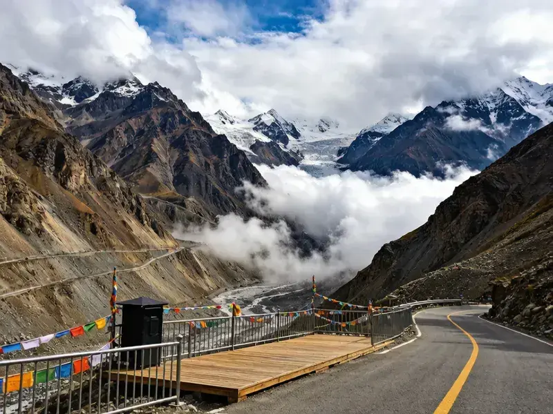
There are two kinds of people who drive the G318: those racing to Lhasa, and those here for the mountains. I'm the latter. Across 2,200 kilometers, the Sichuan-Tibet Highway cuts through the Hengduan Mountains and the Tibetan Plateau. Along the route rise at least ten snow peaks above 6,000 meters. They aren't ordinary mountains—in Tibetan Buddhism, each one is a deity.
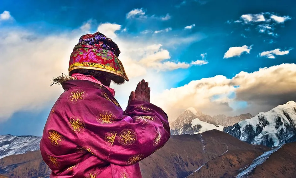
This guide arranges ten sacred mountains in order from east to west along G318, telling you where to see each one, when you're most likely to catch them, and what stories they carry. It's not a tick-the-box list—it's a way to turn a drive into a pilgrimage, to slow down at the moments that matter, and to understand why Tibetans bow to peaks the way others bow in cathedrals. By the time you cross all ten, you won't have just driven a road; you'll have passed through a landscape that has been prayed to for a thousand years.
One honest note before the first peak: most of these mountains don't cooperate on demand. The sacred ones have moods—clouds, monsoon, and the famous refusal of Namcha Barwa to reveal itself. So treat this guide as a matter of patience, not itinerary. The mountain will decide when to show you. Your only job is to be standing in the right place, at the right season, with your camera ready when it does. The good news is that with a little seasonal planning—winter for the east, spring and autumn for the Tsangpo gorge—most of these ten can be caught by anyone willing to give them a morning. The great news is that even the ones that hide still leave you a landscape worth the drive. Either way, you win.
🏔️ First: Minya Konka (7,556m) — King of Sichuan Mountains
Viewing spots: South from Zheduo Pass near Kangding, Black Rock City at Gao'ersi Mountain near Xinduqiao, Zimei Pass Best season: October-February (autumn/winter clear skies) Tibetan meaning: "White Ice Mountain"
Minya Konka isn't visible from G318 itself—you need to look south from Zheduo Pass or make a dedicated trip to Zimei Pass (about 70 km off the main route). At 7,556 meters, it's visually so massive it feels "unreal." Black Rock City near Xinduqiao is the prime spot—abandoned stone walls as foreground, the main summit as backdrop. This is the Sichuan-Tibet Highway's most classic snow-mountain composition. The contrast of the dark, weathered stone walls against the blinding white peak is a composition photographers plan whole trips around—and with good reason, because it's the image most people carry home from the 318.
🏔️ Second: Yala Snow Mountain (5,820m) — The Lotus of Tagong Grassland
Viewing spots: Tagong Grassland (35 km north of Xinduqiao), Bamei Town Best season: Year-round (autumn/winter > spring/summer) Tibetan meaning: "Xiaxue Yala Gagbo," the eastern white-yak mountain
Yala dominates the skyline north of Xinduqiao toward Tagong. It stands directly before Tagong Monastery—at sunset, the snow peak turns gold while the monastery's golden roofs glow below. "One mountain, two golds"—the northern G318's most stunning tableau. Just 35 km detour from Xinduqiao, absolutely worth the trip. On clear autumn evenings, the double-gold moment lasts barely fifteen minutes, so arrive at the monastery viewpoint early and wait for the sun to do its work.
🏔️ Third: Genyen Sacred Mountain (6,204m) — Southern Kham's Highest Peak
Viewing spots: Genyen's Eye (~80 km south of Litang), Lenggu Monastery Best season: May-October Tibetan meaning: The 13th goddess mountain among Tibetan Buddhism's 24 sacred mountains
Genyen isn't on the main G318 route—you need to go south from Litang about 80 kilometers. But its pyramidal form is the most symmetrical and beautifully shaped of all snow mountains along the Sichuan-Tibet Highway. Genyen's Eye is a small circular lake directly facing the main summit—on a clear day, the reflection looks like an eye reflecting the mountain, hence the name. This spot has gone viral since 2020, and it's now busy enough that you may queue for your photo. The 80-km detour is worth it for the silhouette alone, but the lake's mirror reflection is what makes it unforgettable.
🏔️ Fourth to Sixth: Daocheng's Three Sacred Mountains
Viewing spots: Daocheng Yading Scenic Area (230 km south of Litang, off the main G318)
- Chenrezig / Xiannairi (6,032m): Avalokiteshvara Bodhisattva, the most dignified
- Jampelyang / Yangmaiyong (5,958m): Manjushri Bodhisattva, the most elegant, pyramidal form
- Chanadorje / Xianuoduoji (5,958m): Vajrapani Bodhisattva, the most precipitous
Daocheng Yading is off the main G318, but many travelers detour south from Litang. The round trip from Litang is about 230 km each way—budget at least one extra day. The three peaks rise around the famous Milk Lake and Five-Color Lake, and the short trek to Milk Lake is the easiest way to see all three in one view. If your schedule allows, this detour is the single best mountain day on the entire route.
🏔️ Seventh: Chola Mountain (6,168m) — King of the Northern Route
Viewing spots: Manigango Town in Dege County (on G317, the northern route), Chola Tunnel entrance Best season: May-October
Chola Mountain sits on G317 (the northern Sichuan-Tibet route), not G318. But it deserves mention—the Chola Tunnel (7,079m) was once the world's highest highway tunnel. Its Tibetan name means "the mountain you can't climb." From the tunnel entrance, the full Chola main peak rises in snow and glacier above the road—a hard-edged, dramatic combination of ice and asphalt that's as "hardcore" as the 318 gets, even if it technically sits on the parallel northern route.
🏔️ Eighth: Gyala Peri (7,294m) — Namcha Barwa's Brother
Viewing spots: Sejila Pass (between Nyingchi and Lulang), Lulang Forest viewpoint Best season: March-April, October-November
Gyala Peri and Namcha Barwa face each other across the Yarlung Tsangpo, but Gyala Peri is far less famous—its summit is flat rather than the dramatic sword-point of Namcha Barwa. But from Sejila Pass, the combination of Gyala Peri + Lulang Forest + Niyang River Valley offers a different kind of sweeping grandeur. Where Namcha Barwa stuns with a single sharp peak, Gyala Peri rewards with breadth—a whole panorama of forest, river, and snow that opens out below the pass.
🏔️ Ninth: Namcha Barwa (7,782m) — China's Most Beautiful Snow Mountain
Viewing spots: Sejila Pass, Suosong Village, Zhibai Village Best season: March-April, October-November (avoid monsoon) Tibetan meaning: "Spear thrust into the sky"
The tallest mountain visible from G318, and the hardest to see—shrouded in clouds over 300 days a year. "Nine out of ten never see it" is true. But if you're lucky and it emerges from the clouds at sunrise, the entire peak turns gold—you'll forget every ounce of fatigue from the entire G318 journey. The sword-like summit thrusting into a burning dawn sky is the image that makes the whole 2,200 km worth it. It's also the reason experienced drivers plan their Nyingchi arrival for the morning—the golden window at Sejila Pass is brief and unforgiving.
🏔️ Tenth: Potala Palace (3,700m) — The Sacred Mountain That Isn't a Mountain
The G318's endpoint. Tibetans believe the Red Hill beneath Potala Palace is Avalokiteshvara's bodhimanda. But pilgrimage isn't only prostration—when you've driven 2,200 kilometers and finally look up at the Red Palace's golden roofs from Potala Square, you'll understand why it's the tenth. It isn't a mountain, but it gathers the whole journey's devotion into one place. The ten mountains you crossed were nature's altars; the Potala is the man-made one waiting at the end of the road.
💬 What Do Our Travelers Say?
"Before driving the Sichuan-Tibet Highway, my concept of mountains was just 'tall.' Afterward, I understood—each sacred mountain has a personality. Minya Konka is severe. Yala is gentle. Namcha Barwa is mysterious. Potala Palace is compassionate. Which is the most beautiful? I can't say—but I remember them all." — Shanghai, Photographer A Mao ⭐⭐⭐⭐⭐
"I stayed three days in Xinduqiao just waiting for Minya Konka. On the third morning I woke at 6 AM—Minya Konka's summit was emerging from the clouds. I raced to Black Rock City, hands shaking on the wheel. When I arrived, Minya Konka was completely naked—twenty full minutes with zero cloud. The best landscape photos of my life came from those twenty minutes." — Shenzhen Lao Lu ⭐⭐⭐⭐⭐
"Spent five days waiting for Namcha Barwa and finally caught it at sunrise from Sejila Pass. When the whole peak went gold, my driver—who'd crossed this road a hundred times—pulled over, stepped out, and recited a short prayer. In that moment I understood: even the people who live here every day still stop for the mountain." — Xi'an, Chen ⭐⭐⭐⭐⭐
G318 Isn't a Road—It's a Sacred Mountain Corridor
Each mountain has its own rhythm—some are willing to meet you anytime, others make you wait for days. But when you've finished those 2,200 kilometers and look back at those ten mountains—each one has left a different elevation in your memory. Minya Konka taught you patience, Yala gave you a moment of gold, Namcha Barwa demanded faith, and the Potala rewarded every kilometer.
That's the real architecture of the 318: it isn't a flat line between two cities, but a staircase of peaks, each one asking something different of you and giving back something you can't quite name. The travelers who race it see Lhasa. The travelers who watch the mountains see everything the road was built for. So slow down at the passes, wait a morning for a cloud to lift, and let the sacred ones keep their own schedule. When you stand at last in Potala Square, you'll know you didn't just cross a highway—you moved through a landscape that holds ten thousand years of worship, and you were part of it, however briefly. That's the pilgrimage the 318 was always meant to be.
The mountains will still be there long after your footprints fade, still watching the road, still turning gold at dawn whether or not anyone is looking. That's the humbling truth of driving this corridor: you are small, brief, and passing through—but for a few days you got to move beneath the same peaks that have anchored a culture's faith for a millennium. Hold that scale in your head on the flight home. It's the rarest souvenir the 318 offers, the one that can't fit in a suitcase, and the one that stays with you longest. Go to the mountains, wait for them, and let them leave that mark on you. That's what the ten sacred mountains are for.
Craving a worry-free yet free-spirited journey?
Don't want to plan it yourself? Contact our senior trip designer now for a route and quote tailored to you.
Updated: August 2026 Author: RoamFun Senior Travel Consultant Questions? Contact us: vip@roamfun.net

RoamFun Senior Travel Consultant
Travel DesignerProfessional travel consultant, curating the most practical travel guides for you.