Hoh Xil Nature Reserve Complete Guide: Into the Forbidden Zone on the Roof of the World
"Hoh Xil" means "beautiful maiden" in Mongolian. The irony: this 45,000 km² region is China's largest uninhabited zone, averaging 4,500m altitude with only 45% of sea-level oxygen. Winter lows hit -46°C. Conditions deadly for humans—yet a paradise for Tibetan antelopes, wild yaks, and kiangs.
In 2017, Hoh Xil became a UNESCO World Heritage site. Lu Chuan's 2004 film Kekexili: Mountain Patrol immortalized the story of rangers fighting poachers to protect the Tibetan antelope. For ordinary travelers, the Qinghai-Tibet Highway (G109) offers the only accessible glimpse—cutting through the reserve's eastern edge.
🦌 Wildlife Guide
| Animal | Best Time | Common Location | ID Feature |
|---|---|---|---|
| Tibetan Antelope | Jun-Aug (migration) | Kunlun Pass–Wudaoliang | Light brown, males have lyre-shaped black horns |
| Kiang (Wild Ass) | Year-round | Grasslands near road | Larger than domestic donkeys |
| Wild Yak | Year-round | Distant plains | Twice domestic yak size, black hair dragging ground |
| Tibetan Fox | Year-round | Near pika burrows | Square face, perpetually unimpressed expression |
| Tibetan Gazelle | Year-round | Roadside meadows | White heart-shaped rump patch |
| Black-necked Crane | Jun-Sep | Wetlands, lakes | Grey body + black head and neck |
Photo tips: 400mm+ telephoto lens essential. Never leave the road to get closer—getting stuck is potentially fatal. Wear muted colors. Dawn and dusk are most active times.
⚠️ Never leave the highway. Hoh Xil's uninhabited status is literal—no signal, no facilities, no people for hundreds of kilometers.
🗺️ G109 Stop-by-Stop Guide (from Golmud)
| Stop | Distance | Altitude | Notes |
|---|---|---|---|
| Nachitai (Kunlun Spring) | 90km | 3,700m | Glacial spring water, gas station, first rest stop |
| Xidatan | 130km | 4,100m | Best Yuzhu Peak viewing; railway runs parallel here |
| Kunlun Pass | 160km | 4,768m | Sonam Dargye monument; gateway to Hoh Xil |
| Budongquan | 190km | 4,600m | Gas, food, basic lodging—last reliable supply point |
| Sonam Dargye Protection Station | 250km | 4,500m | Only public-access station; rescued antelope calves |
| Wudaoliang | 270km | 4,700m | Lowest oxygen levels; not recommended for most |
Suggested turnaround: Sonam Dargye Protection Station. Beyond lies true no-man's-land—recommended only with extensive high-altitude experience and proper off-road vehicles.
📅 Best Season & Day Trip Plan
| Season | Temp | Conditions | Rating |
|---|---|---|---|
| Jun-Aug | 0-15°C | Antelope migration, green grass | ⭐⭐⭐⭐⭐ |
| Sep-Oct | -5-10°C | Golden autumn, stable weather | ⭐⭐⭐⭐ |
| Nov-Mar | -20~-5°C | Ice and extreme cold | ⭐ Avoid |
| Apr-May | -5-10°C | Warming but windy/dusty | ⭐⭐ |
One-Day Itinerary (Golmud Departure)
| Time | Activity | Altitude |
|---|---|---|
| 7:00 | Depart Golmud, buy oxygen | 2,800m |
| 8:30 | Nachitai rest stop | 3,700m |
| 10:00 | Xidatan—photograph Yuzhu Peak | 4,100m |
| 11:00 | Kunlun Pass—pay respects at monument | 4,768m |
| 12:00 | Sonam Dargye Protection Station | 4,500m |
| 13:30 | Lunch at Budongquan | 4,600m |
| 14:30 | Return to Golmud | — |
| 17:30 | Arrive Golmud | 2,800m |
🎒 Essential Gear
| Category | Must-Have | Notes |
|---|---|---|
| Oxygen | Canned O₂ ×2/person | ~15-20 RMB at Golmud pharmacies |
| Medicine | Glucose, ibuprofen, rhodiola (1 week prior) | Ibuprofen for altitude headaches |
| Clothing | Down jacket (even July!), windbreaker, hat, gloves | Pass winds penetrate anything |
| Sun | SPF50+, sunglasses, lip balm | UV 3-5× stronger than sea level |
| Vehicle | Full tank, spare tire, tow rope | Check everything before departure |
⚠️ Safety Checklist
- Altitude is the biggest danger—acclimatize at Golmud (2,800m) for at least half a day
- Oxygen: minimum 2 bottles per person. Headache, nausea, breathing difficulty → use oxygen and descend
- Fuel: fill up at Golmud. Budongquan has gas but expensive and sometimes out
- Weather: can flip from clear skies to hailstorm in 10 minutes
- Phone signal: gone past Kunlun Pass. Download offline maps beforehand
- Wild yaks: solitary bulls are aggressive—can flip an SUV. Don't stop near them
- No trash cans: pack everything out
💬 Traveler Reviews
"Stood at the Sonam Dargye monument at Kunlun Pass for a long time. The wind was so strong I could barely stand, but the khata scarves and barley wine offerings left by passing Tibetan drivers were still there. Hoh Xil isn't a 'scenic spot'—that golden-brown grassland, distant snow peaks, occasional antelopes... you realize humans are just passing through." — Zhao, Beijing ⭐⭐⭐⭐⭐
"Saw a rescued baby antelope at the protection station. The keeper said its mother was killed by poachers; they found it still standing beside her. I'll never forget that look. Bought souvenirs and donated 500 RMB—not much, but I want more people to know and protect this place." — Lin, Chengdu ⭐⭐⭐⭐⭐
Hoh Xil Isn't a Tourist Destination—It's a Place to Learn Humility
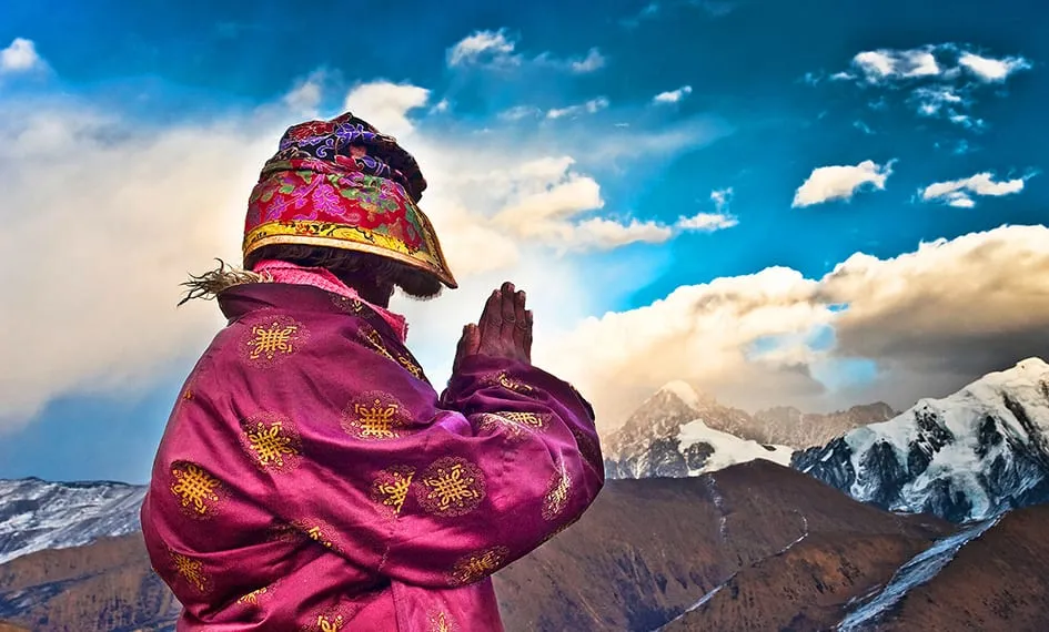
Everything you see here—antelope migration routes, wild yak silhouettes, prayer flags snapping at Kunlun Pass—none of it exists for your camera. These creatures and landscapes have been quietly living their own lives for millions of years.
You're just lucky enough to pass through.
Want a worry-free yet flexible trip?
Get Your Free Route Plan & Quote
Last updated: July 2026 | Author: RoamFun Senior Travel Consultant | Contact: vip@roamfun.net
Craving a worry-free yet free-spirited journey?
Don't want to plan it yourself? Contact our senior trip designer now for a route and quote tailored to you.

RoamFun Senior Travel Consultant
Travel DesignerProfessional travel consultant, curating the most practical travel guides for you.