
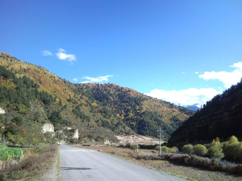
Xiahe to Zhagana Driving Route: Two Main Ways In, With Every Key Junction Marked
A client once sent me a screenshot: the map app said "Xiahe–Zhagana, 4h 12m" in black and white. He'd booked his Zhagana guesthouse around that timing and was planning to catch the sunset. I told him: the route you're looking at defaults to the Zhuoni line. It looks faster, but you won't actually drive it that way — because if you do, you'll miss half of what makes Gannan worth coming to.
The trouble with this leg isn't that it's hard to find. It's that there are two legitimate ways to go, and both make sense. Pick the wrong one and you haven't got lost — you've just driven a hundred useless kilometres, or skipped a string of sights that were literally beside the road. I did no homework the first time I drove it, followed the app toward Minxian, saw nothing but the Bailong River valley, and only realised once I hit Diebu that I'd driven straight past Gahai Lake and Langmusi.
So this piece isn't about scenery, it's about how to drive it. I'll walk through the junctions in the order you reach them: which way to turn, why, and what it costs you if you get it wrong. Plus how to choose between the two routes — who should take which, and when to switch.
😤 Pick Your Side First: Two Options, Know What You Want
| Option | Distance | Pure driving | Road | Best for |
|---|---|---|---|---|
| A: via Langmusi (standard) | ~280 km | 5.5–6h | Mostly G213; final stretch on winding county road X412 | First time in Gannan; want Gahai Lake and Langmusi en route |
| B: via Zhuoni–Minxian–Diebu | ~360–380 km | 7–7.5h | Mostly national/provincial roads, wider and flatter | Already done Langmusi; just want Zhagana; nervous about mountain roads |
In one line: A has more sights but is slower, B is faster but emptier. For a first trip to Gannan I'd recommend A almost without hesitating — Sangke Grassland, Gahai Lake and Langmusi all sit on it, so you're folding the entry fees into the fuel bill. B's value is predictability: wide surface, gentle gradients, fewer trucks, much more reassuring in rain or snow or for a nervous driver.
There's a rarely used third: Xiahe → Hezuo → Lintan → Zhuoni → Dayugou → Zhagana. Beautiful, but the road condition is the least reliable. Don't try it without a local guide.
🚗 Set Up Your Navigation Before You Leave: Three Easy Mistakes
- Don't just search "Zhagana." It resolves to either "Zhagana Village" or "Zhagana Scenic Area Car Park," which are several kilometres apart. Search "Zhagana Scenic Area Visitor Centre" instead.
- Add intermediate waypoints. If you want route A, manually add "Luqu" → "Langmusi" → "Zhagana." Otherwise the app will very likely push you onto B.
- Download offline maps in advance. Signal gets patchy south of Hezuo, and especially on the Langmusi–Zhagana stretch where tunnels and hollows kill reception. I download the whole Gannan region at the hotel the night before.
🗺️ Route A, Junction by Junction (Recommended)
Junction 1: Xiahe town exit — look for the G213 toward Hezuo
There's only one main road out of Xiahe, but as you leave you'll see signs for both "Sangke Grassland" and "Hezuo." If you want Sangke, turn left for 15 km into the grassland and rejoin the G213 afterwards; otherwise head straight for Hezuo. Don't dither here — half an hour to an hour in Sangke is plenty.
Junction 2: Hezuo city — take the ring road, don't go through town
Hezuo is the prefectural capital and its Milarepa Pagoda is worth a stop (around 20 yuan, one hour). But if you're just passing through, the app will route you through the centre, where rush hour can cost you half an hour. Follow the signs for the ring road rather than letting the app drag you downtown.
Junction 3: The G213 fork south of Hezuo — stay on the main road
No real forks here. Stick to the G213 toward Luqu. Grassland and yaks start appearing, and signs read "Luqu" and "Maqu."
Junction 4: Outside Luqu county town — turn toward Langmusi
This is the single most important junction on the whole leg. On the outskirts of Luqu, the G213 continues south toward Maqu and Jiuzhi; you need to turn southeast onto the provincial road for Langmusi. The sign reads "Langmusi 65 km." Miss it and you'll run all the way to Maqu, a hundred kilometres of extra driving.
- Watch out: the sign is small and harder to read at night. If it's getting late, sleep in Luqu rather than pushing on.
Junction 5: Langmusi town — drive through, then toward Zhagana
Langmusi has one main street. Drive through it, exit south, and join the X412. From here begins the hardest driving of the day.
Junction 6: County road X412 — follow "Zhagana" and "Diebu" signs
Ninety kilometres of mountain road, passing a few Tibetan villages and a pass or two. Narrow but fully paved; slow down and keep right for oncoming traffic. At the "Zhagana" sign, follow the park directions in — 80 yuan including the shuttle bus.
🎒 Practical Checklist
⚠️ Don't say I didn't warn you: route B looks longer on paper, but its real advantage is a wide surface and gentle gradients. If anyone in the car gets badly carsick, or you hit rain or snow, switch to B without regret. Those last 90 km of switchbacks on A are miserable in wet weather with low visibility.
- Fuel: Xiahe → Hezuo → Luqu → Diebu. Topping up in Hezuo is the safest bet; Langmusi only has a small station.
- Speed limits: dense average-speed cameras on the G213, mostly 60–80. Hezuo to Luqu is where people get caught most.
- Timing: plan 8 hours for A (with stops), 7.5 for B. Don't trust the app's four hours.
- Signal: patchy south of Langmusi. Tell anyone who needs to reach you before you set off.
- Parking: the Zhagana gate backs up badly in peak season — aim to enter before 8 AM.
💡 A Few Honest Truths
Nine times out of ten, people on route A underestimate Langmusi. It isn't just a monastery, it's a small town straddling the Gansu–Sichuan border. Arrive in the afternoon, stay one night, and the mist and incense smoke you see the next morning are things no expensive tour can buy you.
Route B isn't a consolation prize — it's a different trip entirely. I had clients travelling with parents in their seventies. They took B the whole way. An extra hundred kilometres, but neither elder felt carsick once, they spent the day watching the river valley, and told me afterwards it was the most comfortable leg of the holiday.
Don't gamble at the Luqu junction. Dark, rain, unreadable signs — if two of those three show up, stop for the night. County-town rooms in Gannan are cheap and perfectly comfortable for a hundred or two.
Buy Zhagana tickets online in advance. In peak season the queue to scan a code at the gate runs an hour or two. I've literally watched people give up and turn around.
📸 Don't Shoot Blindly — These Spots Work
- Wildflower slopes off the Sangke turn-off: best in July, wide and low, flowers in front, mountains behind.
- Gahai Lake on the Luqu–Langmusi road: a 3,480 m plateau wetland mirroring the snow peaks, full of migratory birds in summer.
- The viewpoint behind Langmusi: 6:30 AM for red walls, gold roofs and the Bailong River in morning mist.
- The high point of the X412: turn back and shoot the road you came up, layered below you.
- Yima township before Zhagana: best colour in autumn — village, barley racks and stone peaks together.
💬 What Travellers Who Came With RoamFun Said
"Following the guide, we turned off at Luqu for Langmusi. We'd planned to just pass through and sleep there, but the next morning's mist nailed me to that hillside for half an hour. If we'd followed the app toward Minxian, we'd have missed all of it." — Ah May, Shanghai ⭐⭐⭐⭐⭐
"We took B with my parents: wide road, almost no traffic, no carsickness at all. An extra hundred kilometres, but worth the peace of mind. Worked out to a few dozen yuan more in fuel." — Lao Zhang, Beijing ⭐⭐⭐⭐
There's No Correct Route, Only the Right One for Your Carload
After all that, it comes down to one sentence: don't treat this as a question with a single right answer. I've driven both many times and chosen differently each trip — first-timers get A; anyone with elderly relatives or small kids, or anyone hitting rainy weather, gets B; when I'm alone and in a hurry I sometimes sleep in Luqu and drive into the mountains early the next morning.
What actually causes trouble is never the choice of route. It's leaving too late and budgeting too little time. It gets dark earlier than you expect up here, the signal is worse than you assume, and when a yak walks onto the road you can only wait. So my last piece of advice, whichever route you pick: be on the road by 8 AM, fill up in Hezuo, and start looking for a place to stay an hour and a half before dark. Do those three things and leave the rest to luck — in Gannan, luck is usually kind.
For the full loop in sequence, see Gannan Self-Driving Loop (/travel-guide/gansu/gansu-gannan-self-driving-loop-guide/); for timings and road conditions, see Xiahe to Zhagana: How Far and How Long (/travel-guide/gansu/gansu-xiahe-zhagana-distance-time-guide/).
Craving a worry-free yet free-spirited journey?
Don't want to plan it yourself? Contact our senior trip designer now for a route and quote tailored to you.
Updated: September 2026 Author: RoamFun Senior Travel Consultant Questions? Contact us: vip@roamfun.net

RoamFun Senior Travel Consultant
Travel DesignerProfessional travel consultant, curating the most practical travel guides for you.